
So, What's New?
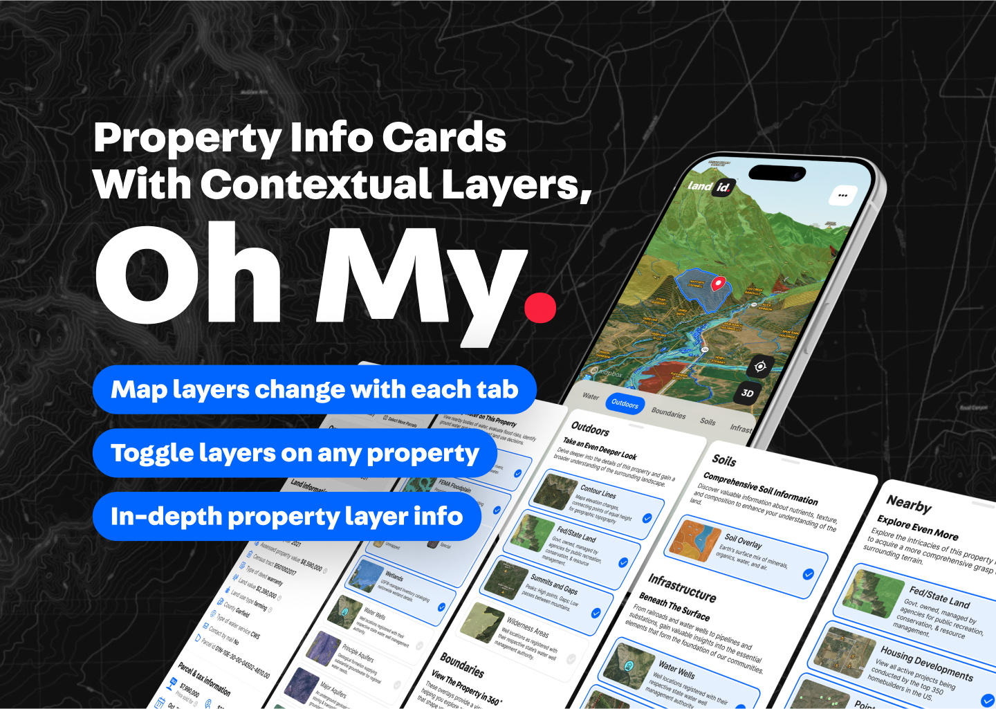
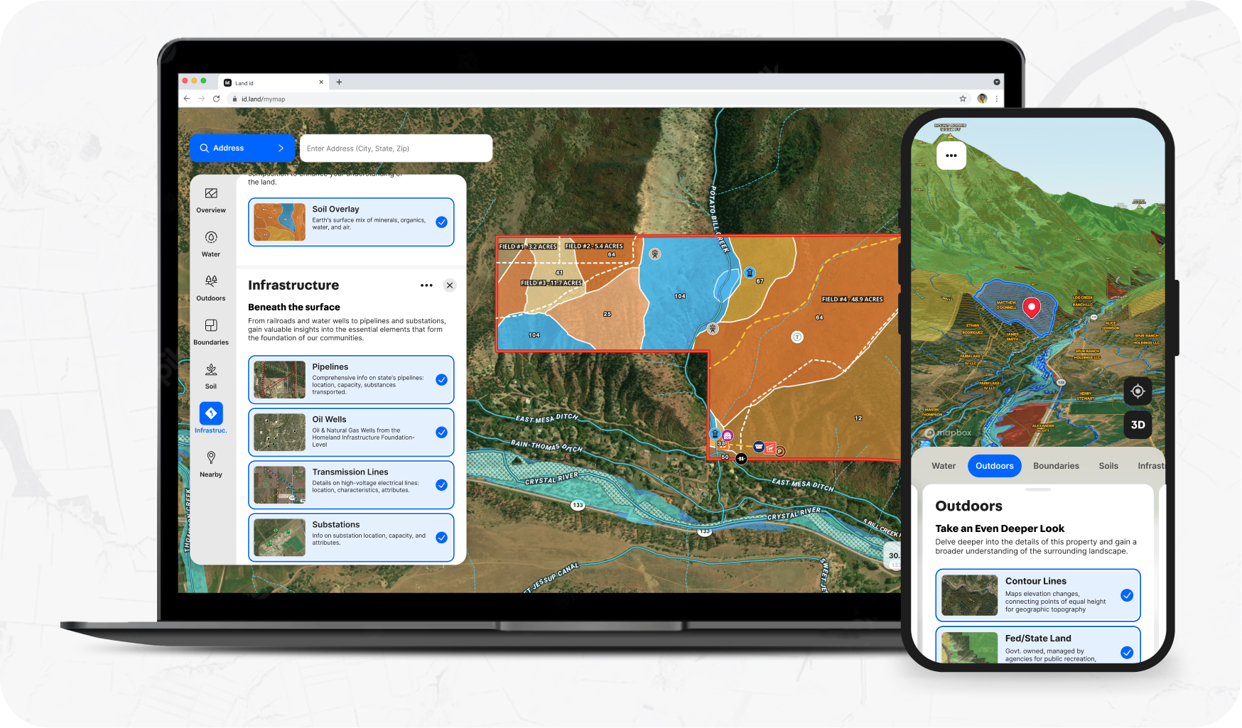
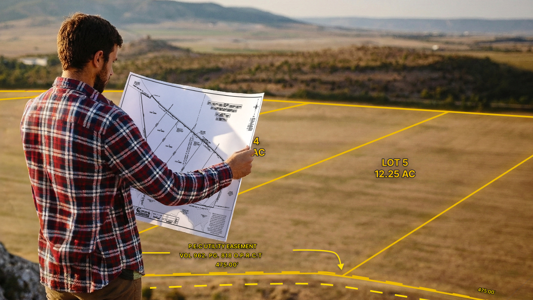
Our latest release of the property info card features a newly patented, tabbed system for organizing the extensive land data that Land id® has to offer. With a few swipes or taps, you can now quickly and easily uncover the water, soils, surrounding infrastructure and much more of any property in the USA.
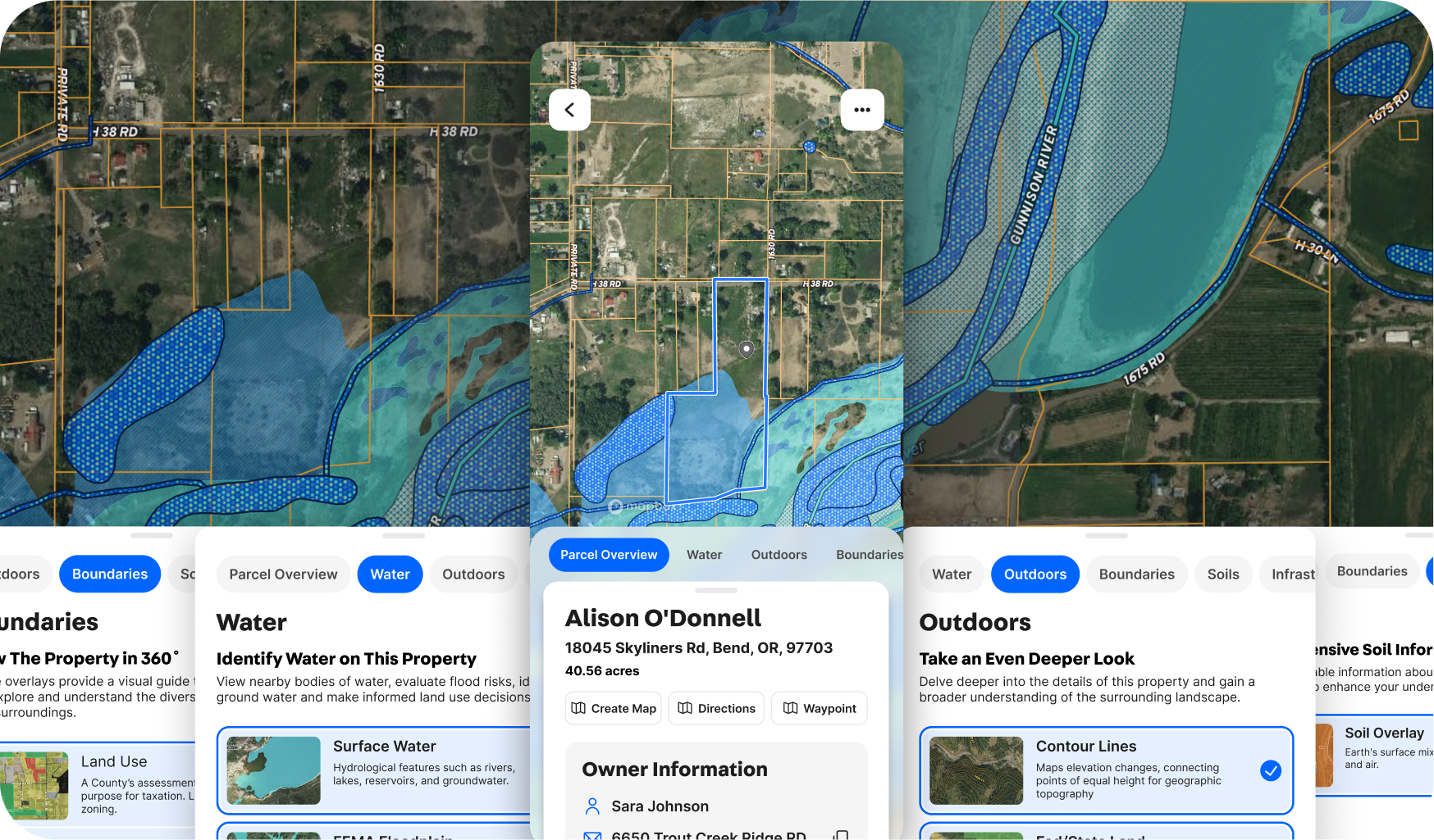
Land id® data is now broken down into 7 different tabs for a better viewing experience:
- Parcel Overview
- Water
- Boundaries
- Soils
- Infrastructure
- Nearby
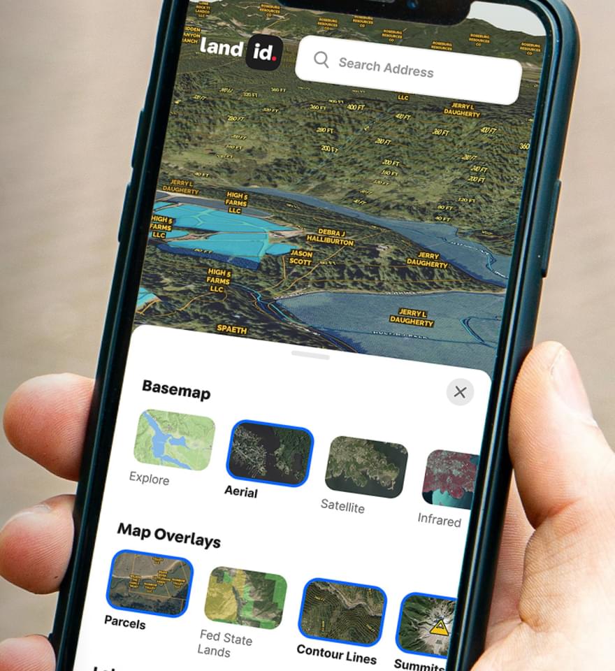
Not only have we made it easier to explore land data, but you can now make a shareable, interactive map of any property right from its parcel card whether you are on a desktop, tablet, or mobile device. We are continuing to streamline the different features within Land id®, and have redesigned our mapping tools to make it easier for you to explore, create, and share your maps on the go.
We believe this update will greatly enhance your experience and efficiency in exploring and sharing land data. Thank you for your continued trust in our solutions. Should you have any questions or need further assistance, please do not hesitate to contact our dedicated support team.
FAQs
Continue Reading
News
A New Benchmark in Property Marketing: The Land id + Luxury Presence Partnership
By Land id
Discover how Land id’s interactive mapping now integrates with Luxury Presence to deliver richer property storytelling and a more engaging path from interest to closing.

What Is a Plat Map? A Guide to Understanding Property Lines & Ownership
By Land id
Get the low-down on plat maps—what they are (and aren't), why they're important, how to use them, and how to work with plats in Land id to gain a deeper understanding of your land's potential.

Explore Private Parcel Data & Property Boundaries
Download the Land id app and try for free.
