
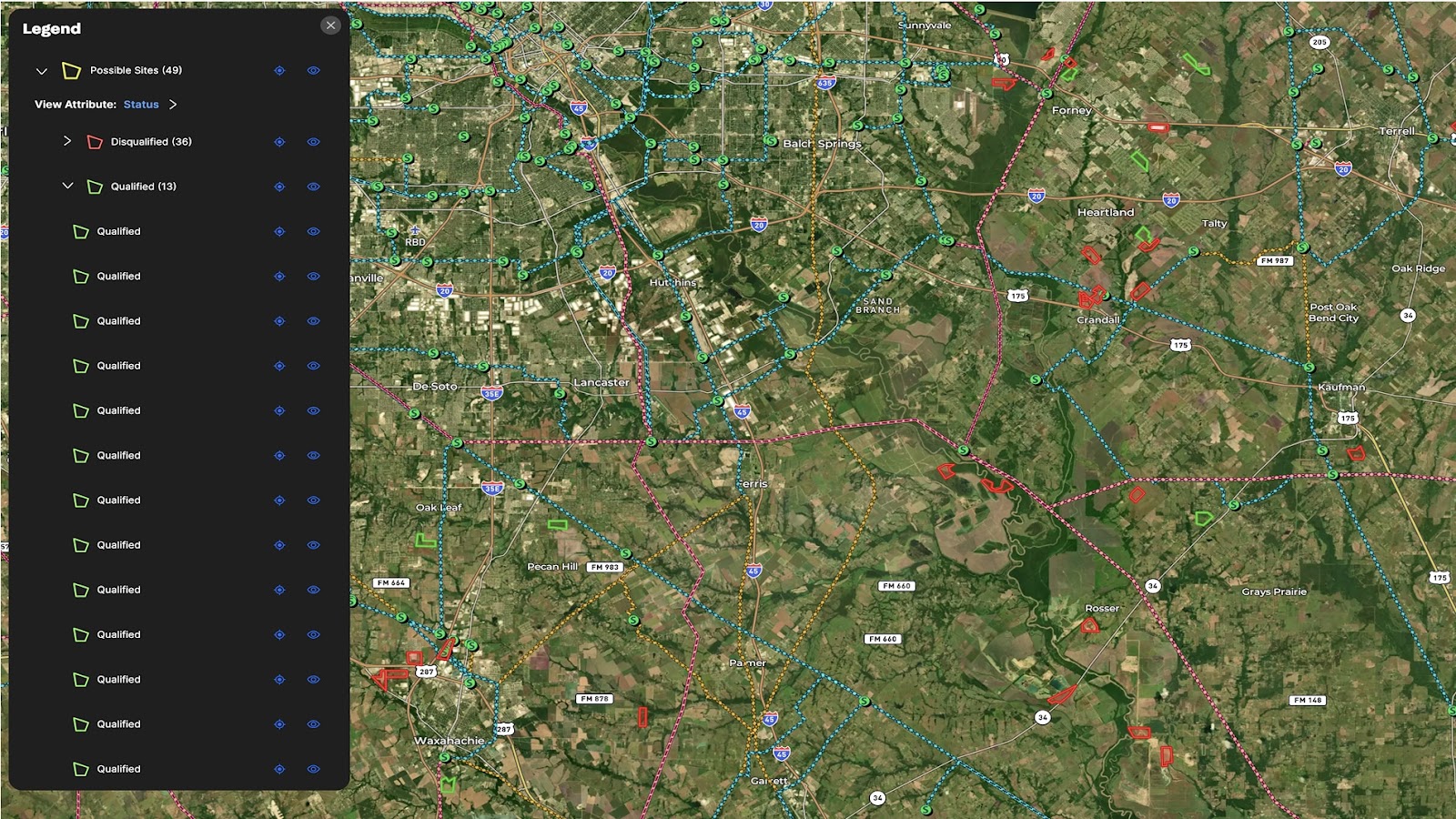
As demand for cloud computing, AI, and digital services continues to surge, the demand for data centers is rising rapidly.
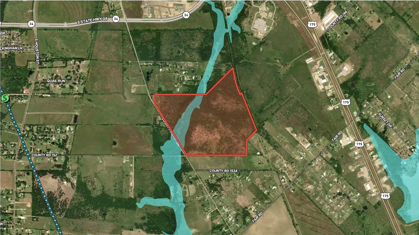
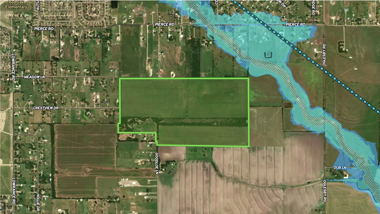
This map is purpose-built for professionals evaluating land for potential data center development. Using Land id®’s powerful overlays—including transmission lines, pipelines, substations, fiber optic infrastructure, floodplains, and wetlands—it enables rapid visual analysis of location viability.
Properties under consideration are documented in an interactive, map-based database, allowing users to filter, compare, and prioritize parcels that meet critical utility and risk criteria. This map turns complex infrastructure and environmental data into actionable insights.
Learn How to Create a Map Like This:
- How to make maps in Land id
- Create and edit boundaries
- Draw detailed maps by adding items
- Manage and visualize data with Attributes
- Overlay Summary
- Transmission lines overlay
- Substations overlay
- FEMA floodplain overlay
- Fiber optic service overlay

Keep Exploring


5.6 Acre Rural Listing in Bozeman, MT

Commercial Real Estate Off-Market Prospecting

Subdivided Lots for Sale
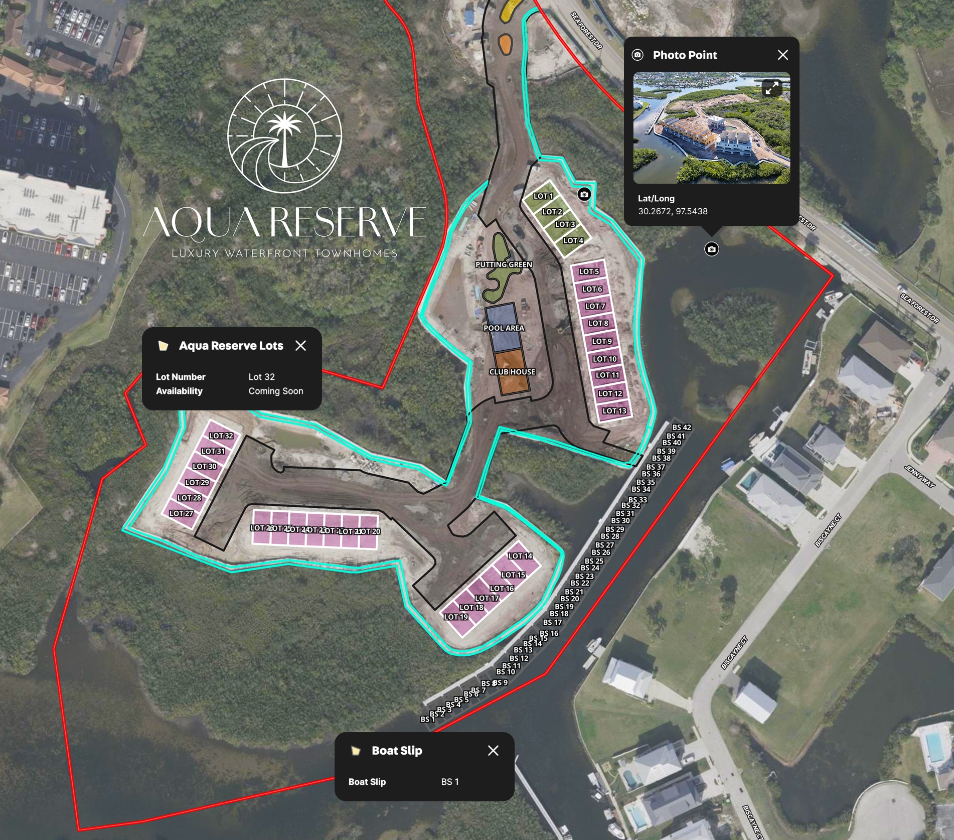
LPT Realty Aqua Reserve Development Map
Take Your Mapping to the Next Level
Mapping is just the beginning. Land id is the #1 tool for researching, discovering, and showcasing land, and we're here to help you make the most of it, every step of the way.

