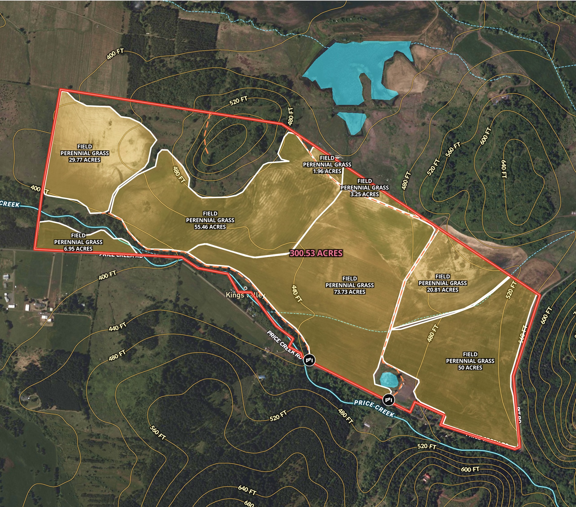
Angie LaPointe uses Land id® GIS mapping software to showcase land parcels with a detailed property map, ideal for real estate marketing and topography insights.
Listing
Agricultural
Rural
Soil
Water
By clicking “Accept All Cookies”, you agree to the storing of cookies on your device to enhance site navigation, analyze site usage, and assist in our marketing efforts. View our Privacy Policy for more information.