
Map Categories
Thank you! Your submission has been received!
Oops! Something went wrong while submitting the form.
000
,
000

Farm & Ranch
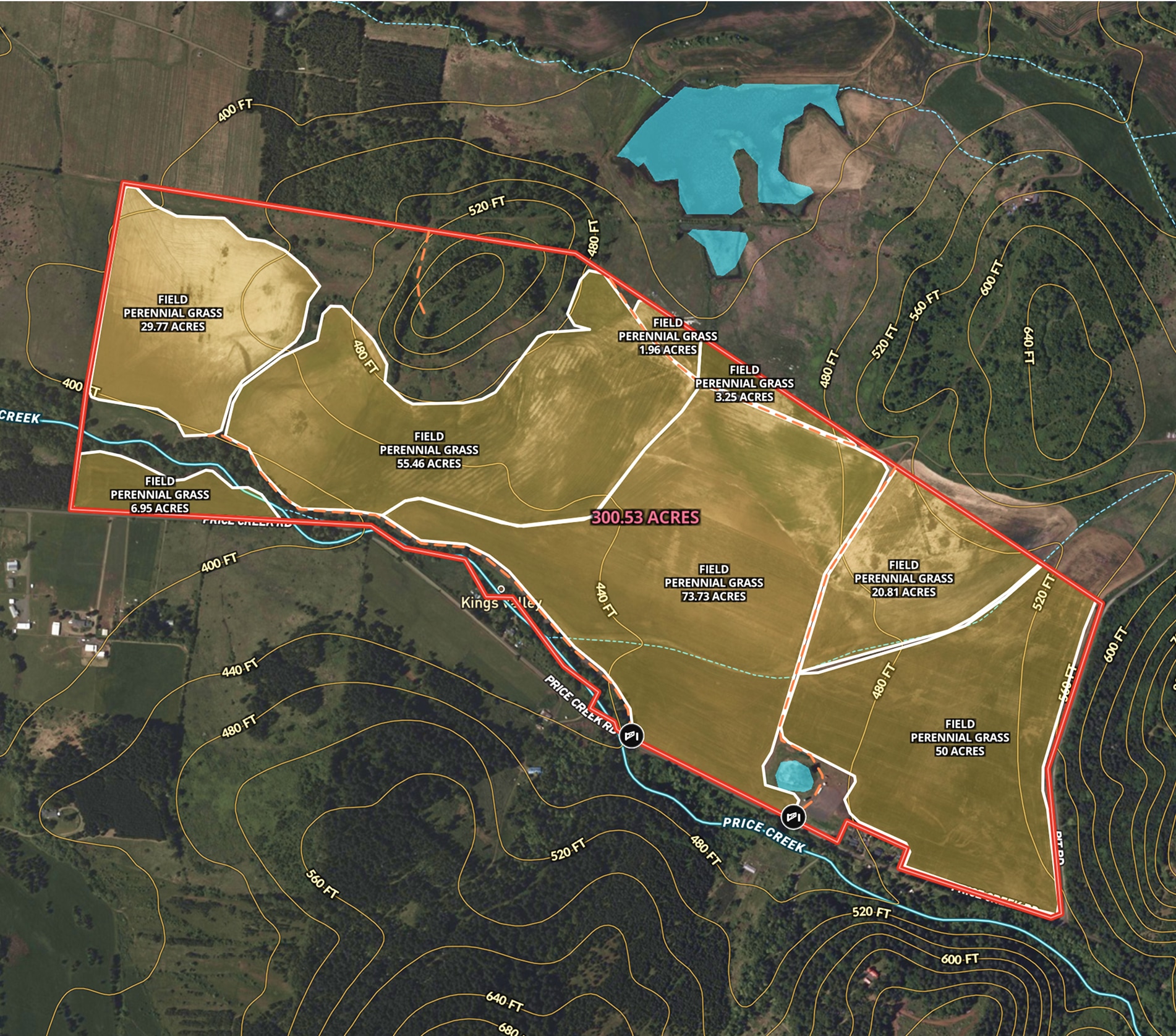
Oregon Farmland Overview – 300 Acres
Angie LaPointe uses Land id® GIS mapping software to showcase land parcels with a detailed property map, ideal for real estate marketing and topography insights.
Listing
Agricultural
Rural
Soil
Water
Farm & Ranch
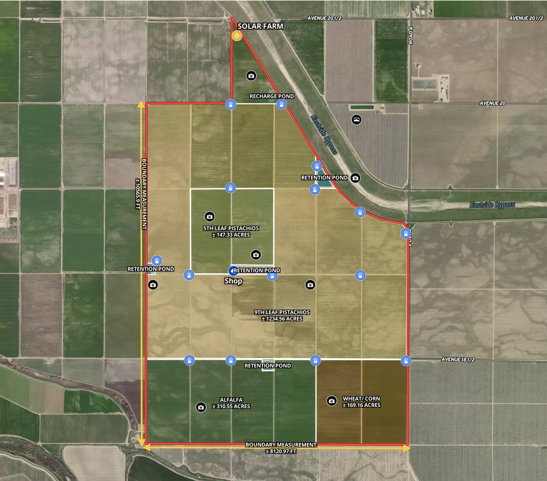
CA Almond Farm – 107 Acres
Todd Peterson uses Land id® GIS mapping software to embed real estate maps that showcase an almond farm details for a standout listing experience.
Listing
Agricultural
Rural
Soil
Water
Farm & Ranch
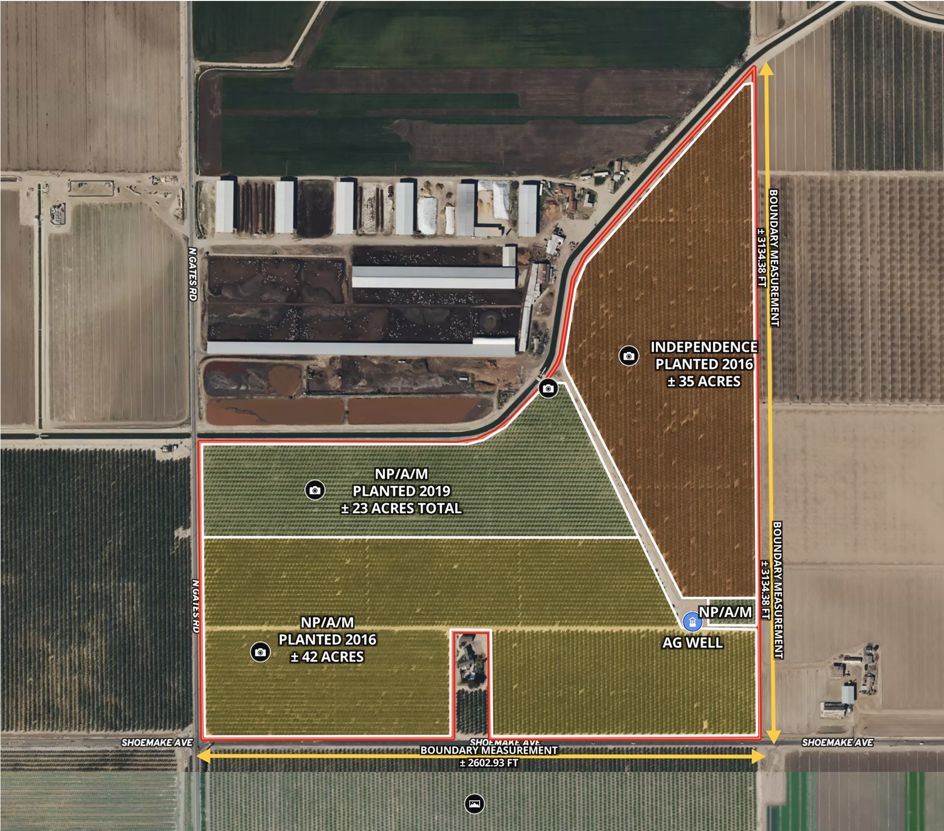
Ag Farm in Madera County, CA
Todd Peterson uses Land id® GIS mapping software to embed real estate maps that showcase detailed layout of productive California farmland.
Listing
Agricultural
Rural
Soil
Water
Farm & Ranch
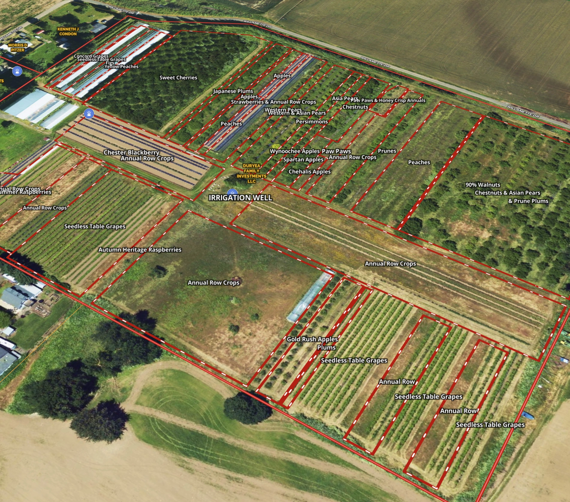
Grateful Harvest Farm
Lisa Johnson and the Horsepower Real Estate team used Land id® GIS mapping software to accurately appraise and sell Grateful Harvest Farm. Detailed property maps and acreage reports enhanced farm land pricing.
Rural
Listing
Agricultural
Soil

Natural Resources
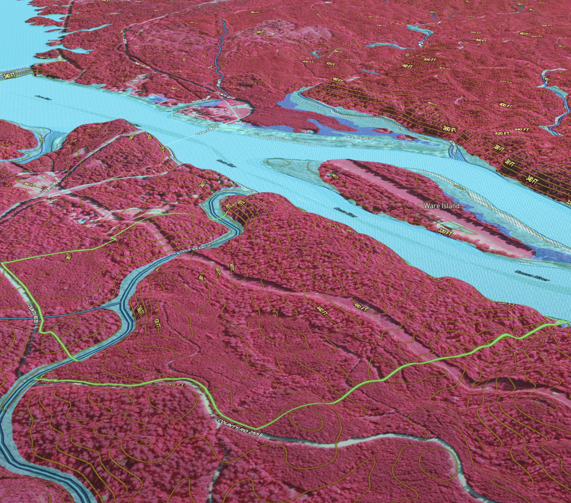
Developing & Assessing Timberlands
Maximize timberland potential with Land id®, featuring Infrared Basemap, soil reports, and essential forestry GIS overlays.
Timber
Soil
Listing
Rural
Forestry
Natural Resources
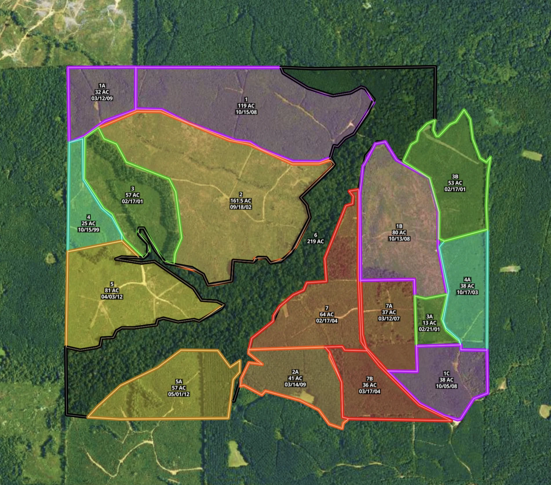
Mississippi Timber Stand Map
Boost your timber sales strategy with Land id®, creating interactive timber maps that highlight timber stand features and access.
Forestry
Timber
Soil
Listing
Rural
Farm & Ranch
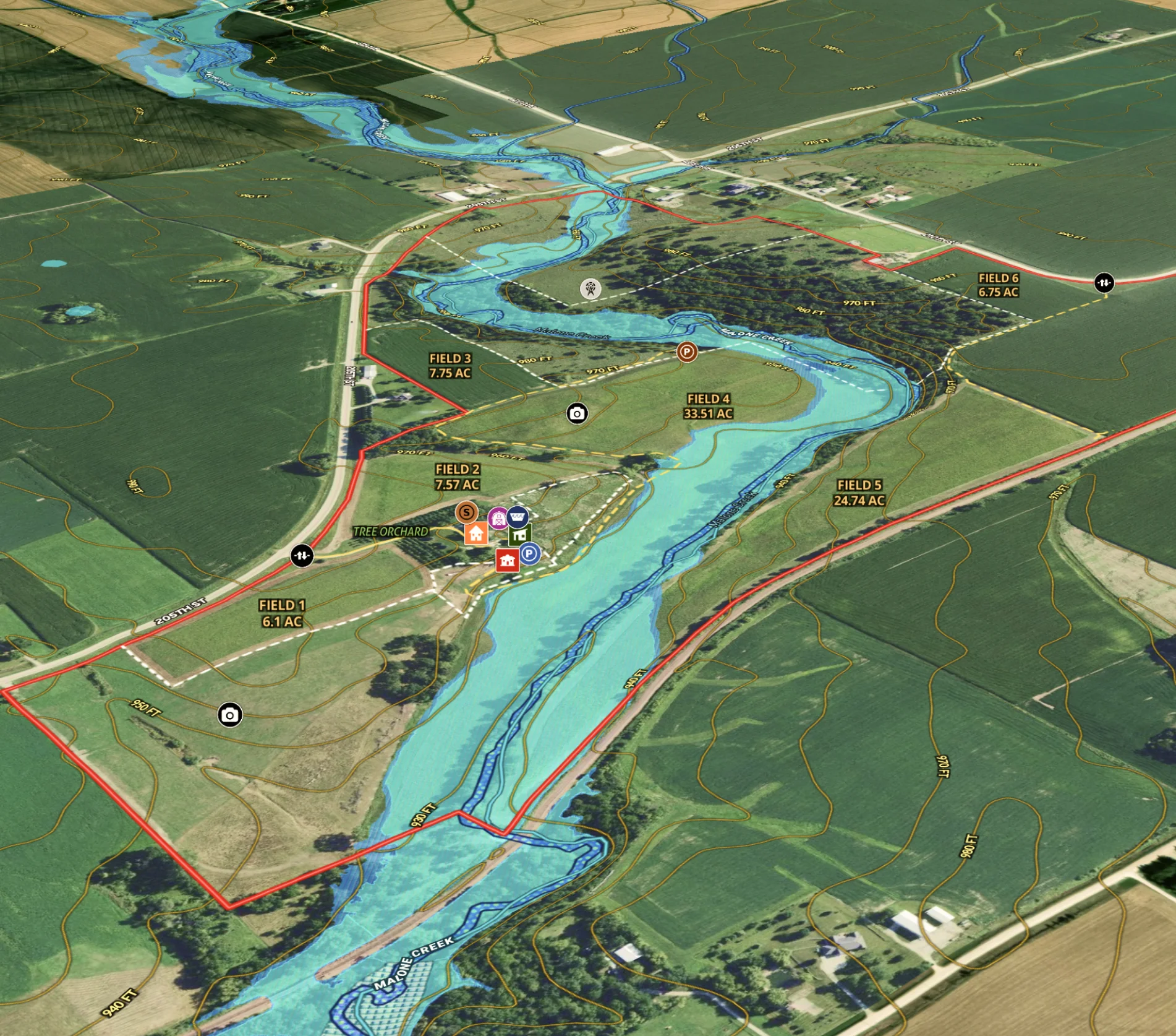
Agricultural Listing for Iowa Farm
Revolutionize farm listings with our real estate mapping software, integrating soil reports and multimedia for a standout presentation.
Agricultural
Listing
Rural
Water
Soil
Farm & Ranch
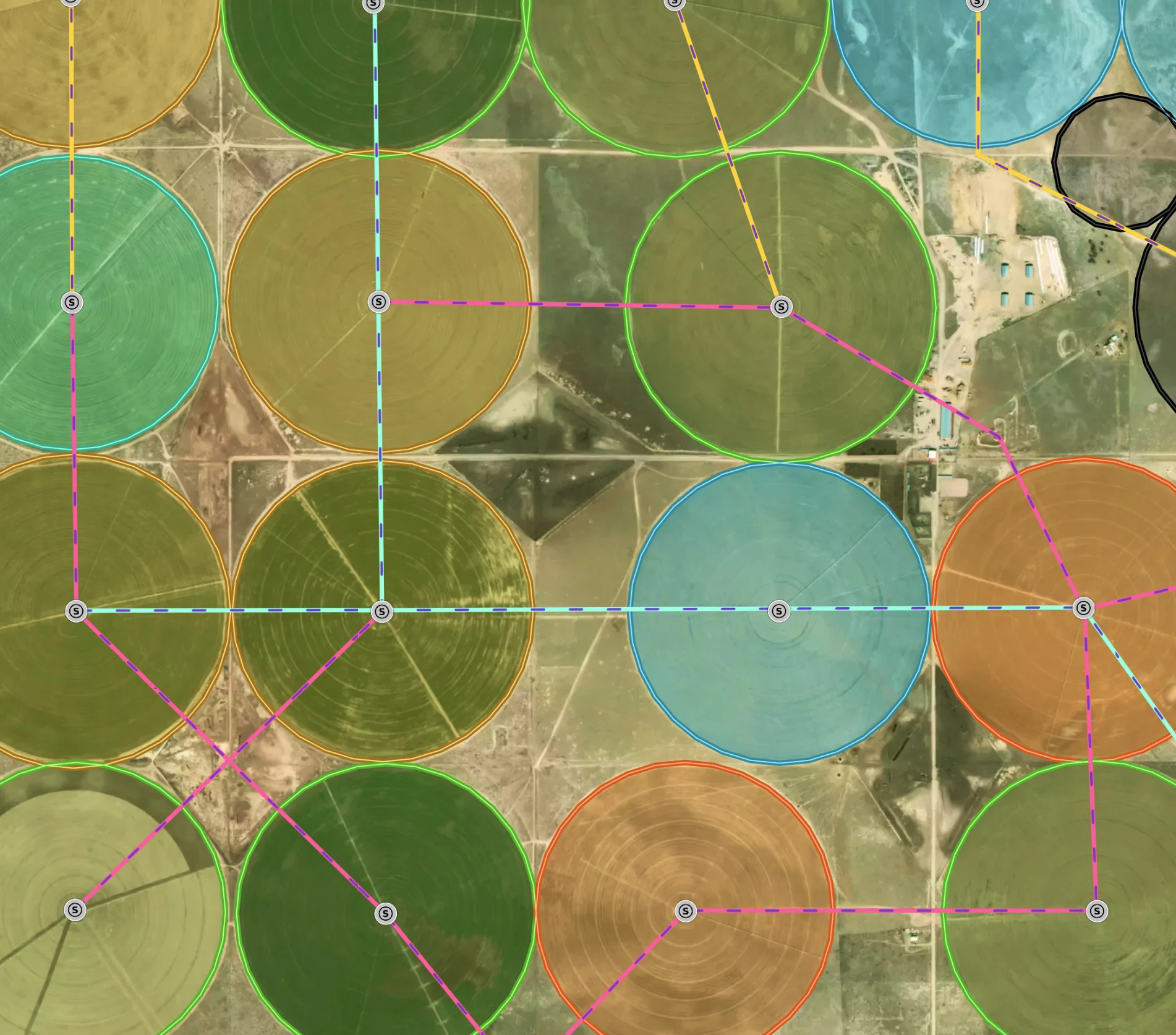
Managing a New Mexico Farm
Elevate farm efficiency with Land id®: Advanced agriculture GIS, field mapping software, and parcel maps for optimized crop and irrigation planning.
Agricultural
Soil
Water
Land owner
Land management