
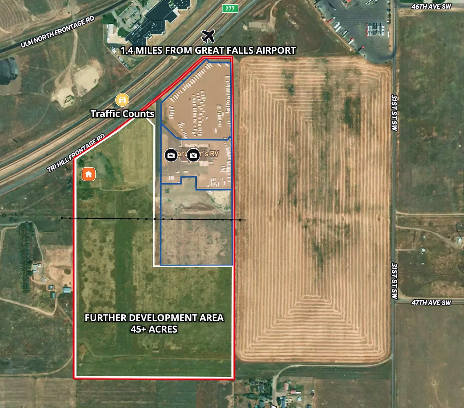
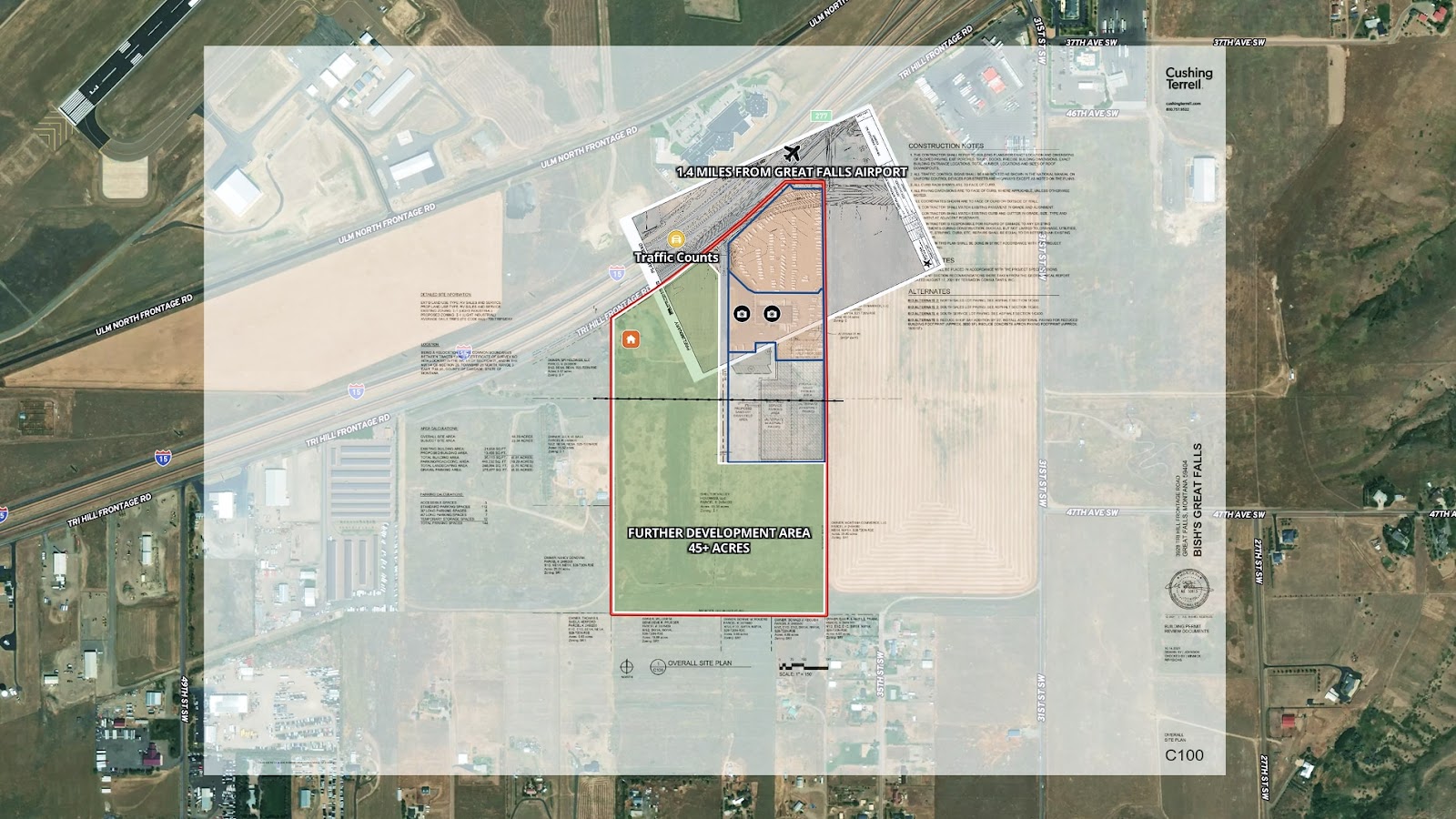
Tyree Real Estate, led by President Burke Tyree, is marketing a versatile 68-acre commercial property located just minutes from the Great Falls International Airport and prominently positioned along the high-traffic corridor of Highway 15. To support their efforts, they needed a listing map that could:
- Highlight the full scope and potential of the commercial site.
- Showcase key access points and surrounding infrastructure.
- Present the property’s location in relation to major highways and nearby amenities.
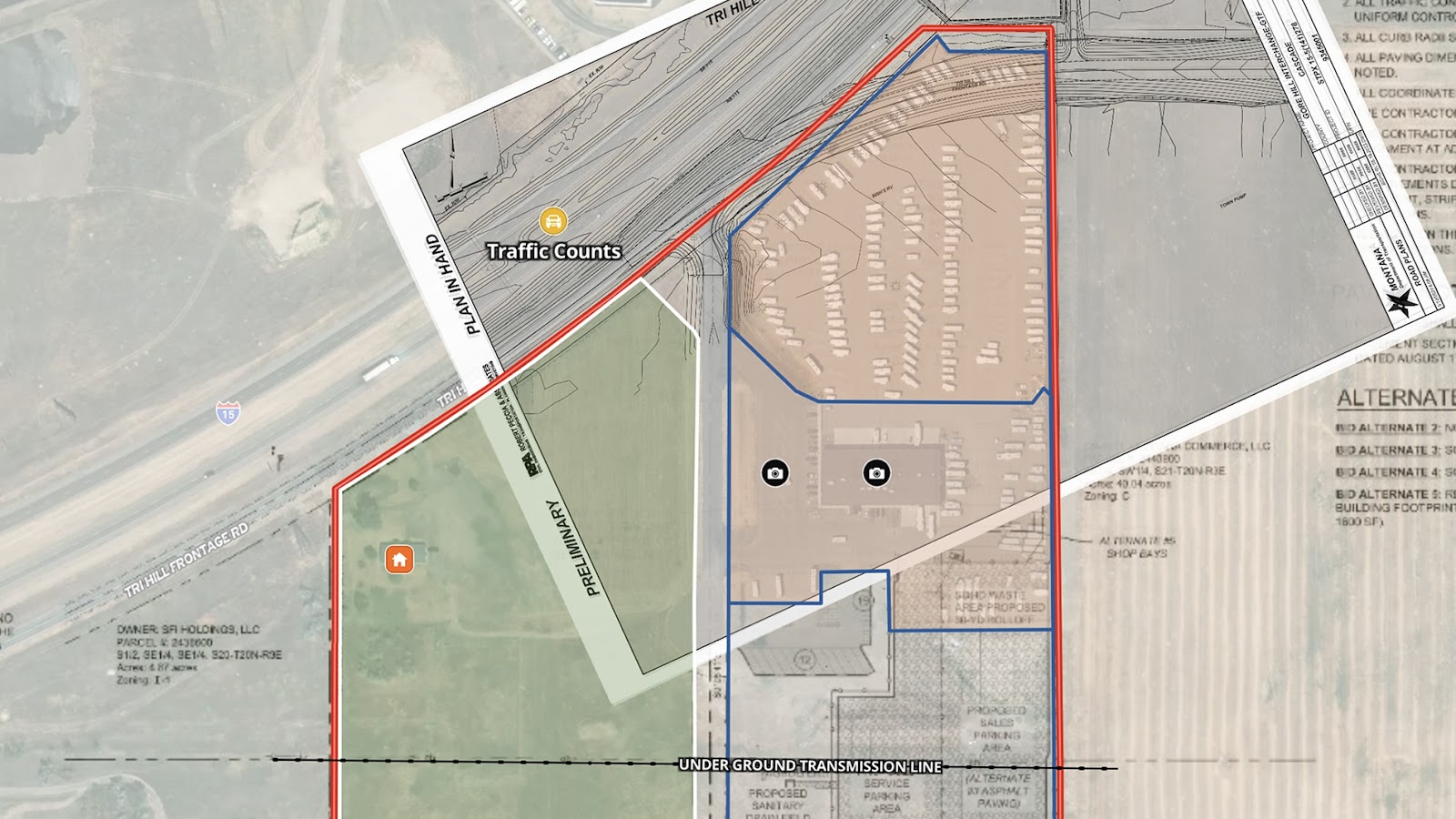
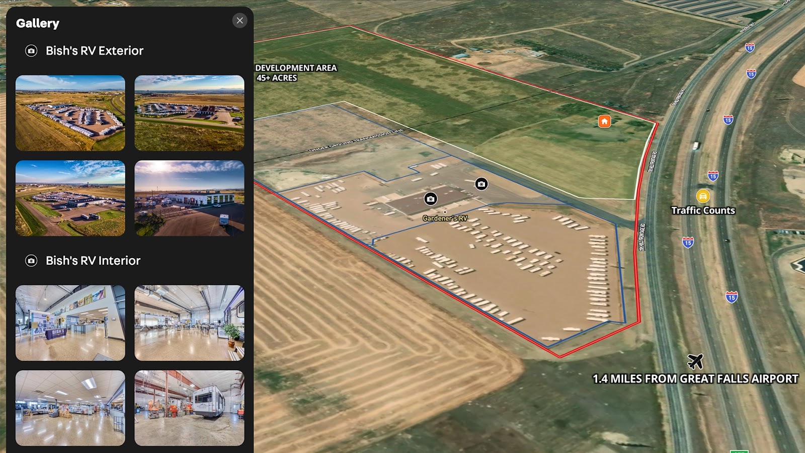
Currently home to a single-family rental unit and an active RV dealership, the property offers excellent visibility, easy highway access, and strong development potential. The map outlines the layout, existing uses, and the opportunity to divide the parcel into two separate tracts—making it a compelling opportunity for investors and developers alike.
With Land id, commercial listings like this can be presented with clarity and confidence, helping buyers quickly assess land use options and future value in high-growth corridors.
Learn How to Create a Map Like This:
- How to make maps in Land id
- Create and edit boundaries
- Import surveys and site plans with the Georeference Tool
- Embed photos, videos, 360° walkthroughs and more onto your map
- Divide a parcel of land in Land id
- Add labels to maps and mapped items
Keep Exploring


5.6 Acre Rural Listing in Bozeman, MT

Commercial Real Estate Off-Market Prospecting

Subdivided Lots for Sale

Data Center Development Site Analysis
Take Your Mapping to the Next Level
Mapping is just the beginning. Land id is the #1 tool for researching, discovering, and showcasing land, and we're here to help you make the most of it, every step of the way.

