
Map Categories
Thank you! Your submission has been received!
Oops! Something went wrong while submitting the form.
000
,
000

Farm & Ranch
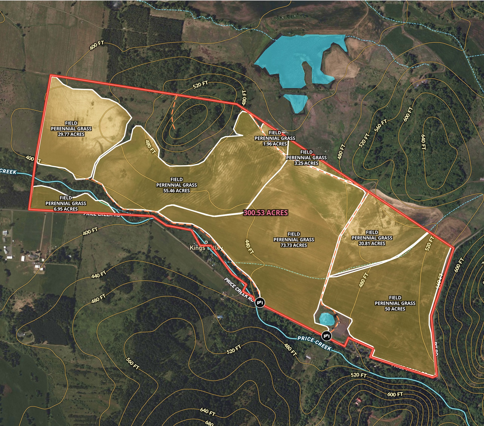
Oregon Farmland Overview – 300 Acres
Angie LaPointe uses Land id® GIS mapping software to showcase land parcels with a detailed property map, ideal for real estate marketing and topography insights.
Listing
Agricultural
Rural
Soil
Water
Farm & Ranch
CA Almond Farm – 107 Acres
Todd Peterson uses Land id® GIS mapping software to embed real estate maps that showcase an almond farm details for a standout listing experience.
Listing
Agricultural
Rural
Soil
Water

Real Estate
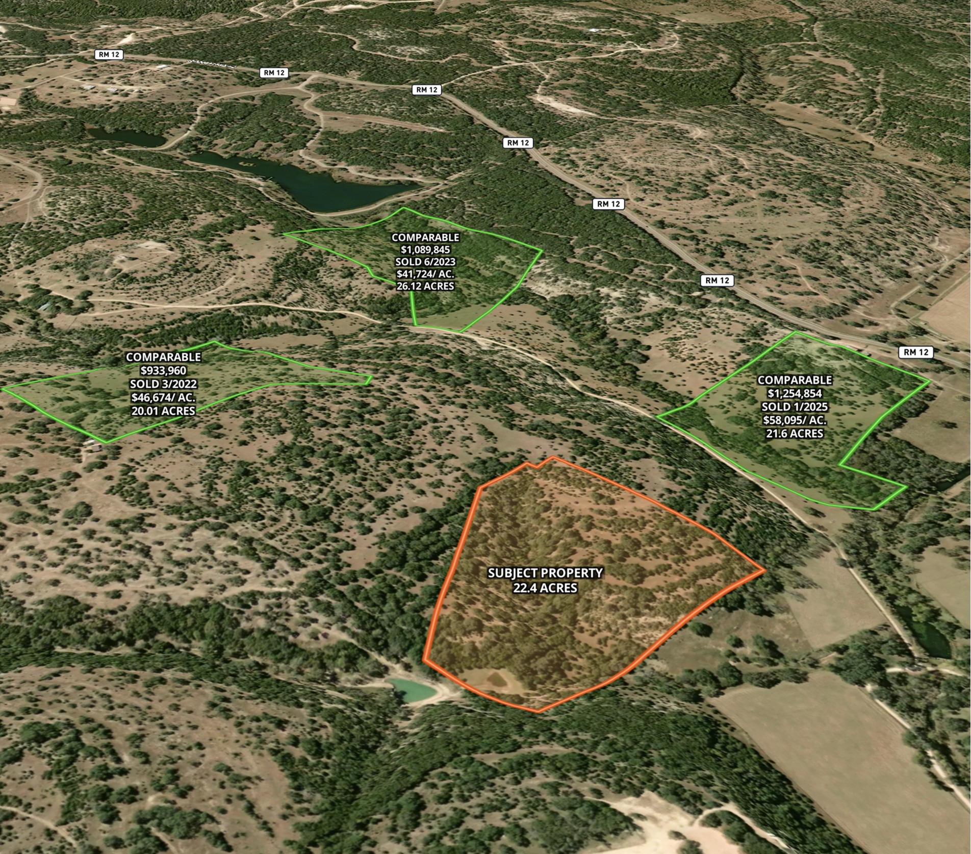
Market Trends Overview – Interactive Comps
Use Land id® GIS mapping software to visualize property comps on a map. Simplify how you present similar land parcels and sales data.
Listing
Agricultural
Rural
Comps
Residential
Farm & Ranch
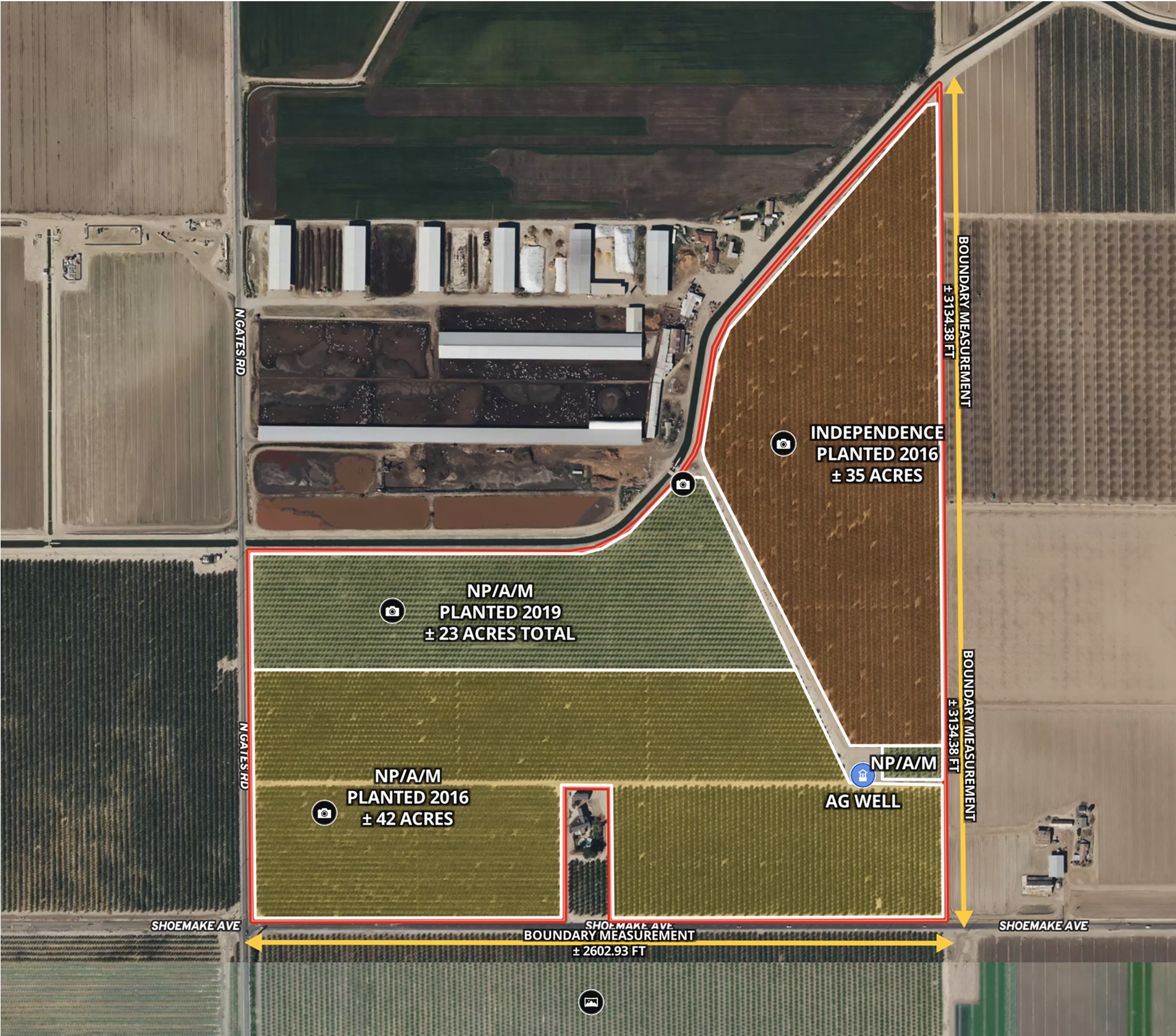
Ag Farm in Madera County, CA
Todd Peterson uses Land id® GIS mapping software to embed real estate maps that showcase detailed layout of productive California farmland.
Listing
Agricultural
Rural
Soil
Water
Real Estate
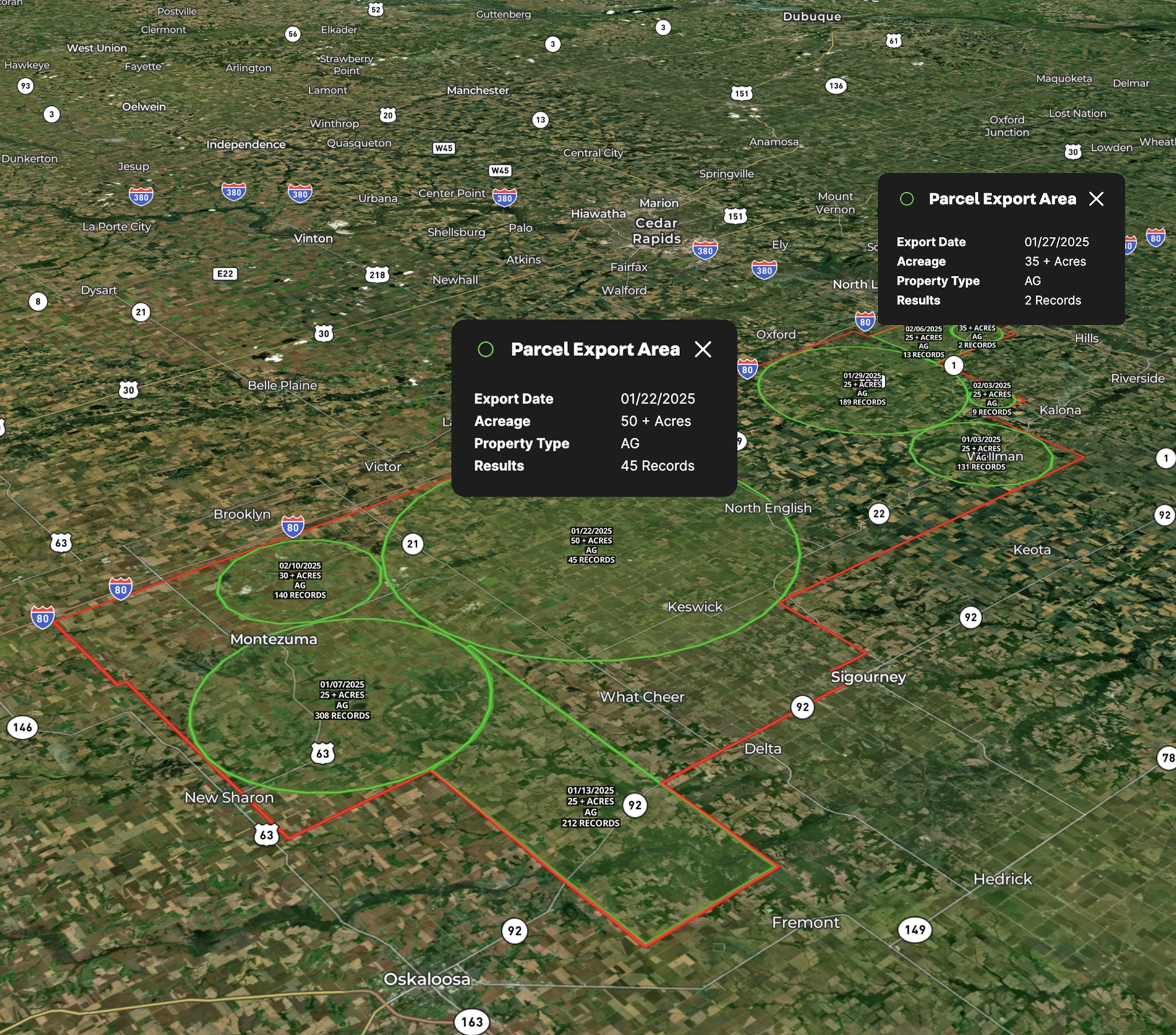
Lead Farming
Land id® GIS mapping software helps you visualize lead areas with a map and track your targeted outreach efforts.
Agricultural
Rural
Commercial
Luxury
Residential
Farm & Ranch
The Broken Fence – Premier Utah Hay Farm
Zeb White uses Land id® GIS mapping software to create a real estate map of The Broken Fence, showcasing land parcels, hay fields, and key property infrastructure.
Agricultural
Listing
Rural
Water
Farm & Ranch
Grateful Harvest Farm
Lisa Johnson and the Horsepower Real Estate team used Land id® GIS mapping software to accurately appraise and sell Grateful Harvest Farm. Detailed property maps and acreage reports enhanced farm land pricing.
Rural
Listing
Agricultural
Soil

Real Estate
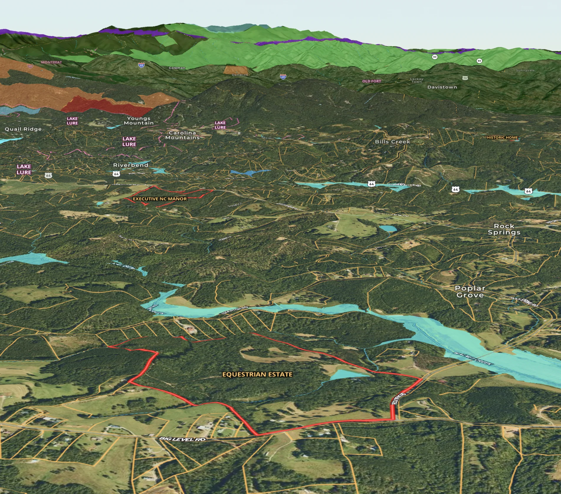
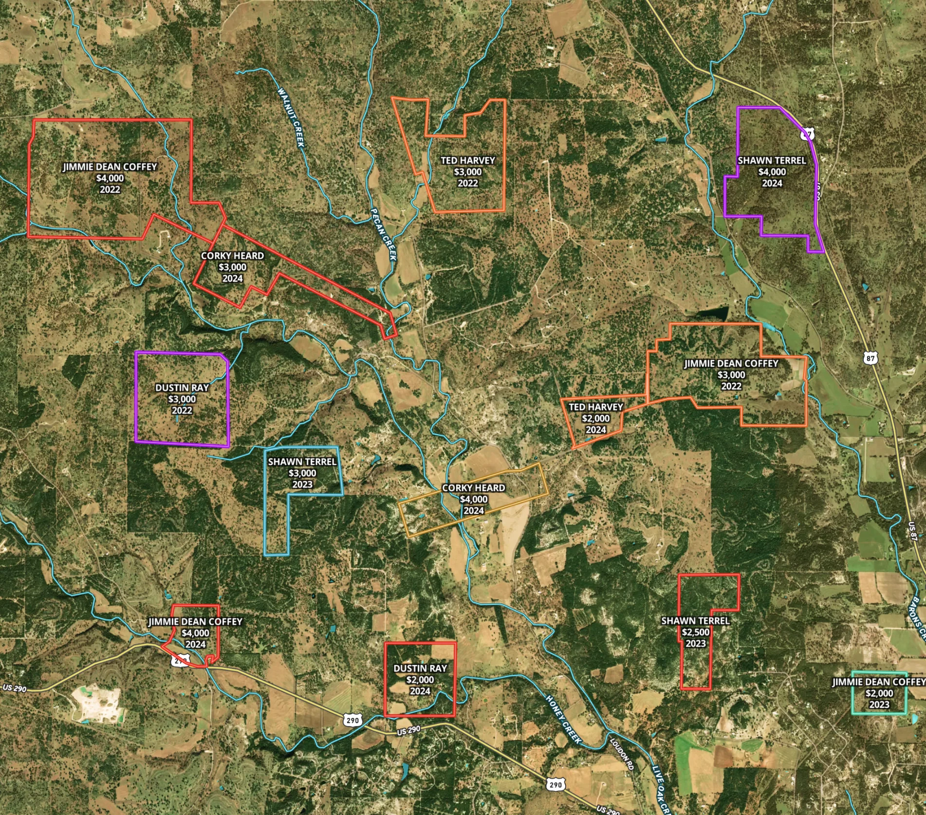
Sandy Creek Ranch
Harlan Ray uses Land id®'s real estate mapping software every day to create detailed property maps, build relationships and showcase expertise.
Listing
Rural
Luxury
Hunt
Agricultural

Real Estate
Round Mountain Ranch
Harlan Ray uses Land id®'s real estate mapping software to create property maps that build relationships. Perfect for easy real estate mapping.
Listing
Rural
Luxury
Agricultural
Real Estate
Buyer Representation Map
Save time with our mapping tool for real estate, allowing buyers to filter potential properties interactively before visiting.
Rural
Agricultural
Real Estate
Comparable Sales
Optimize real estate pricing with Land id®. Create a visual real estate database to track and justify property values effectively.
Luxury
Residential
Agricultural
Commercial
Rural
Farm & Ranch
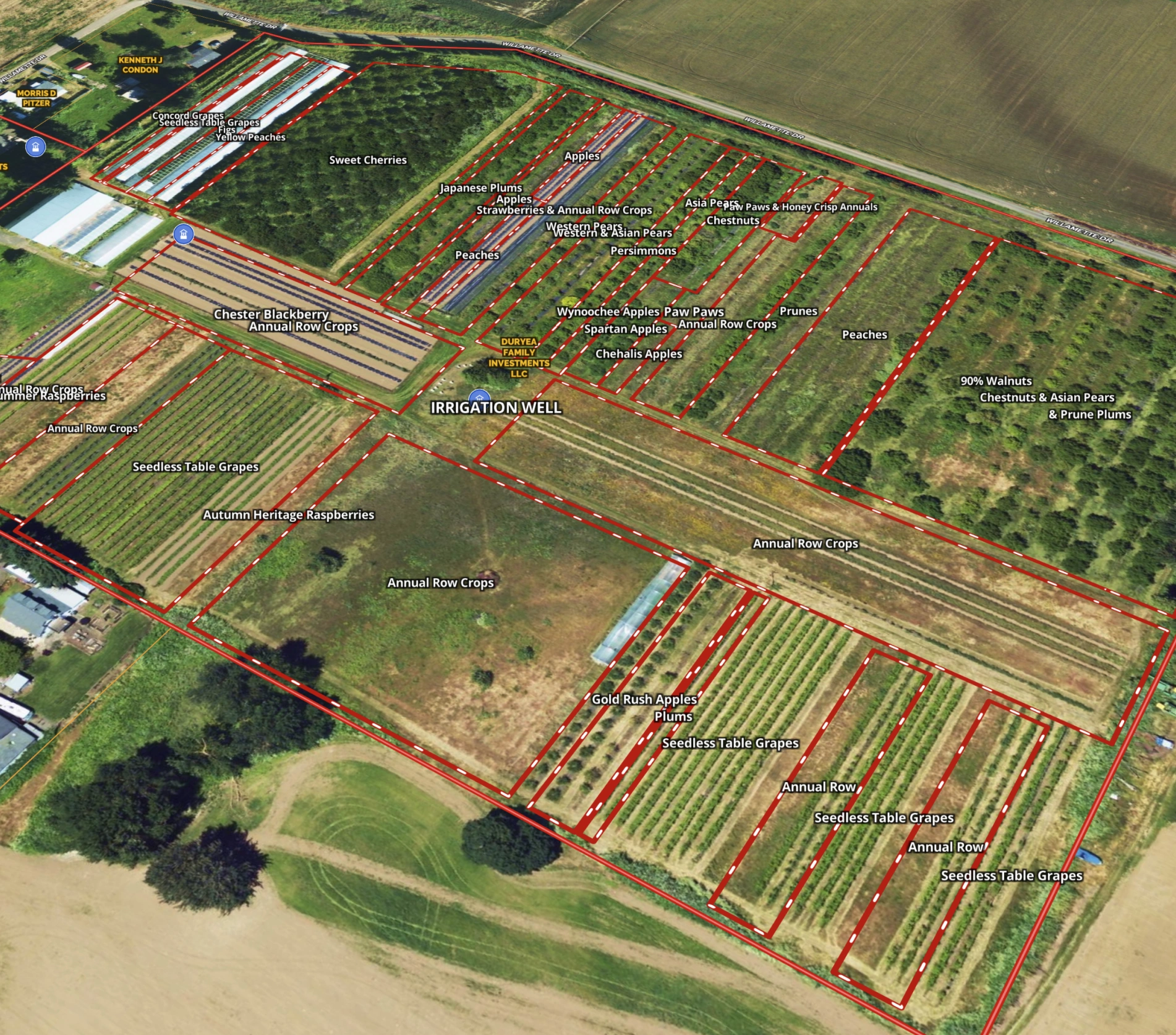
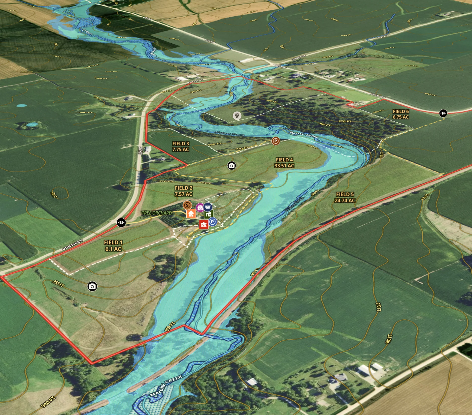
Agricultural Listing for Iowa Farm
Revolutionize farm listings with our real estate mapping software, integrating soil reports and multimedia for a standout presentation.
Agricultural
Listing
Rural
Water
Soil
Farm & Ranch
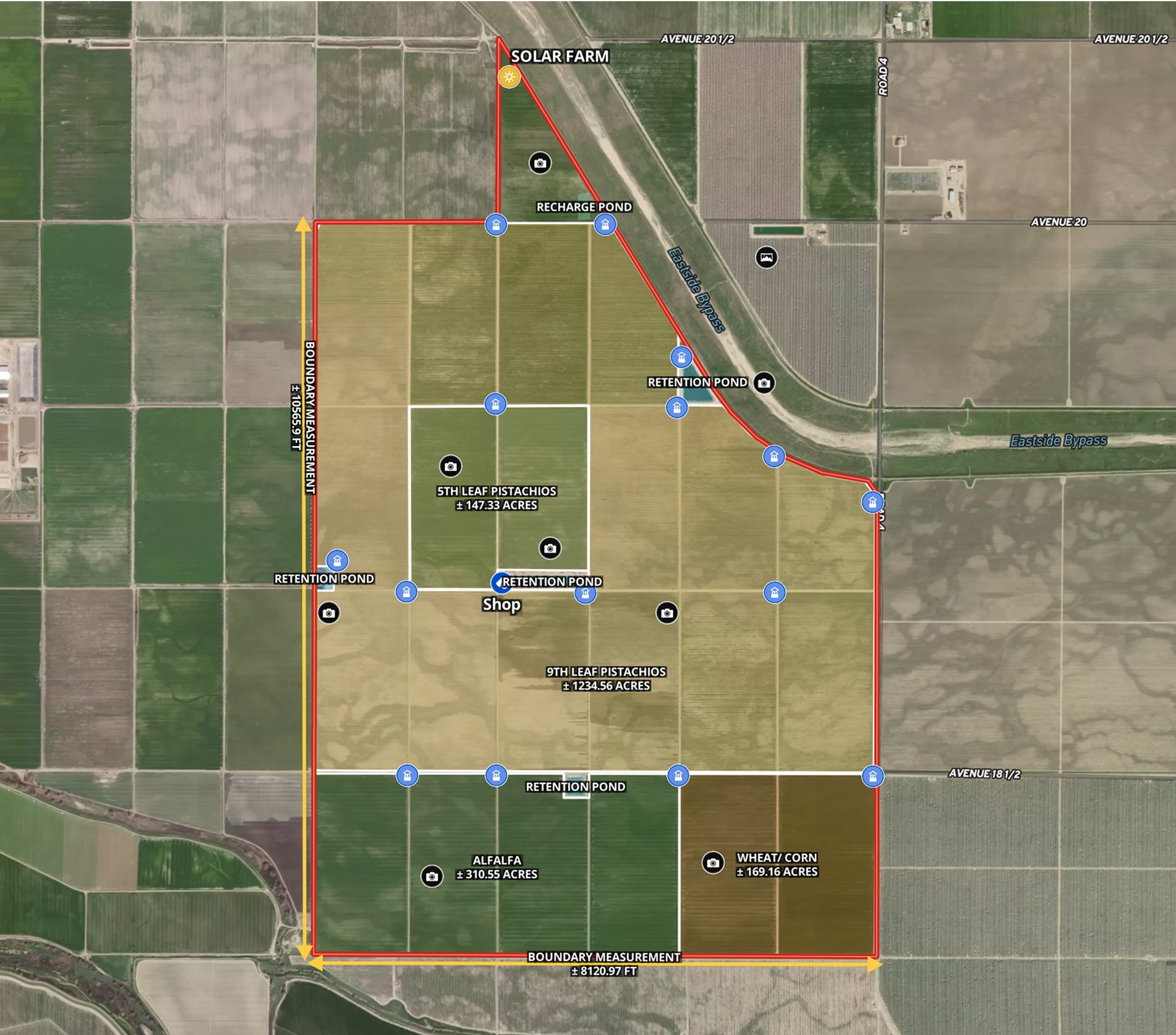
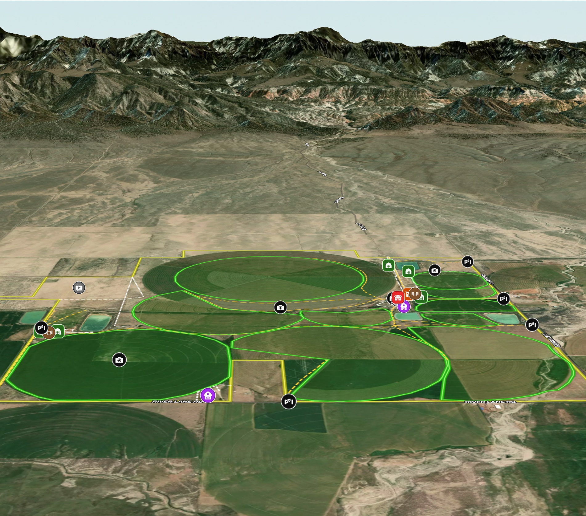
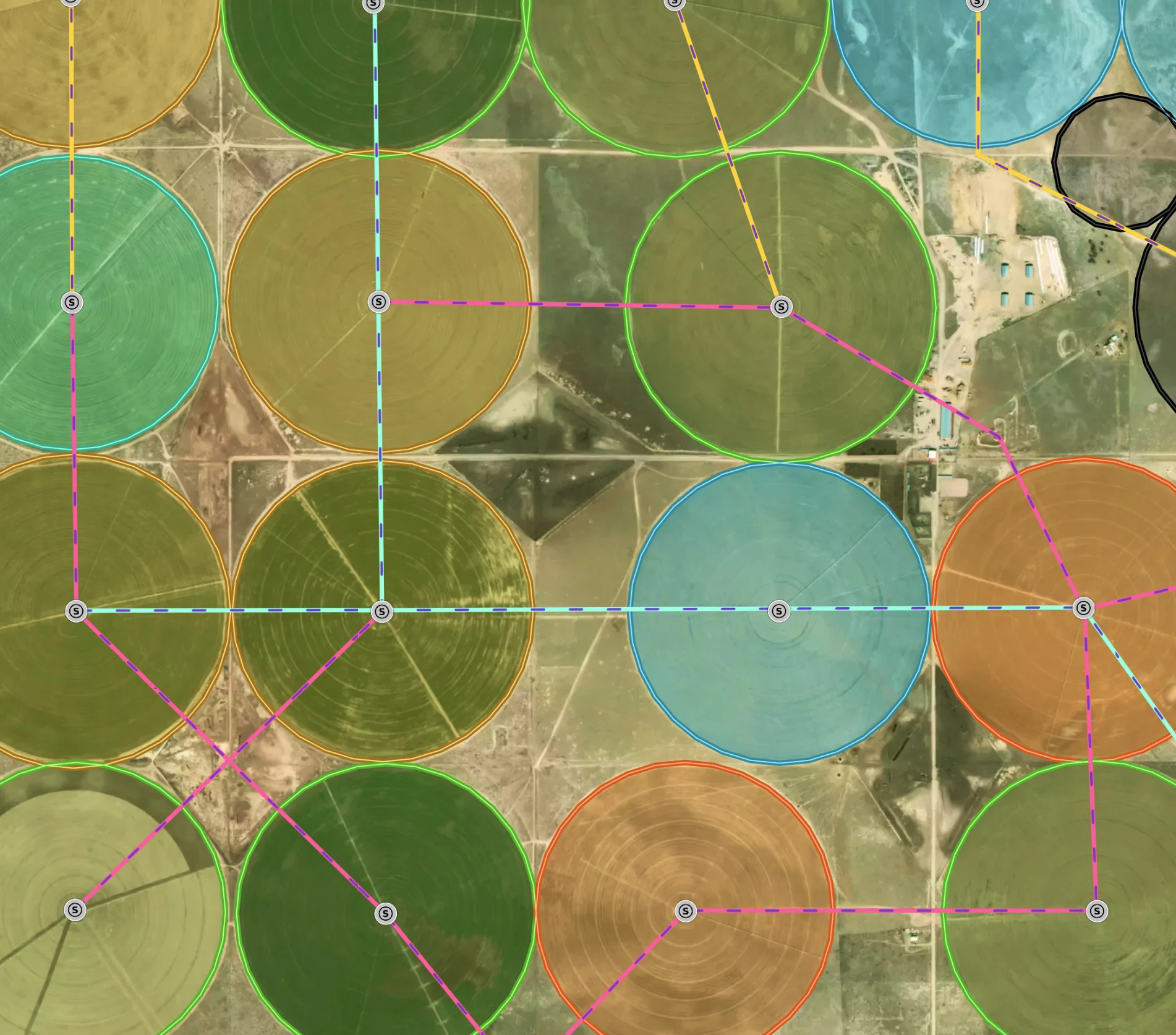
Managing a New Mexico Farm
Elevate farm efficiency with Land id®: Advanced agriculture GIS, field mapping software, and parcel maps for optimized crop and irrigation planning.
Agricultural
Soil
Water
Land owner
Land management