
Map Categories
Thank you! Your submission has been received!
Oops! Something went wrong while submitting the form.
000
,
000

Real Estate
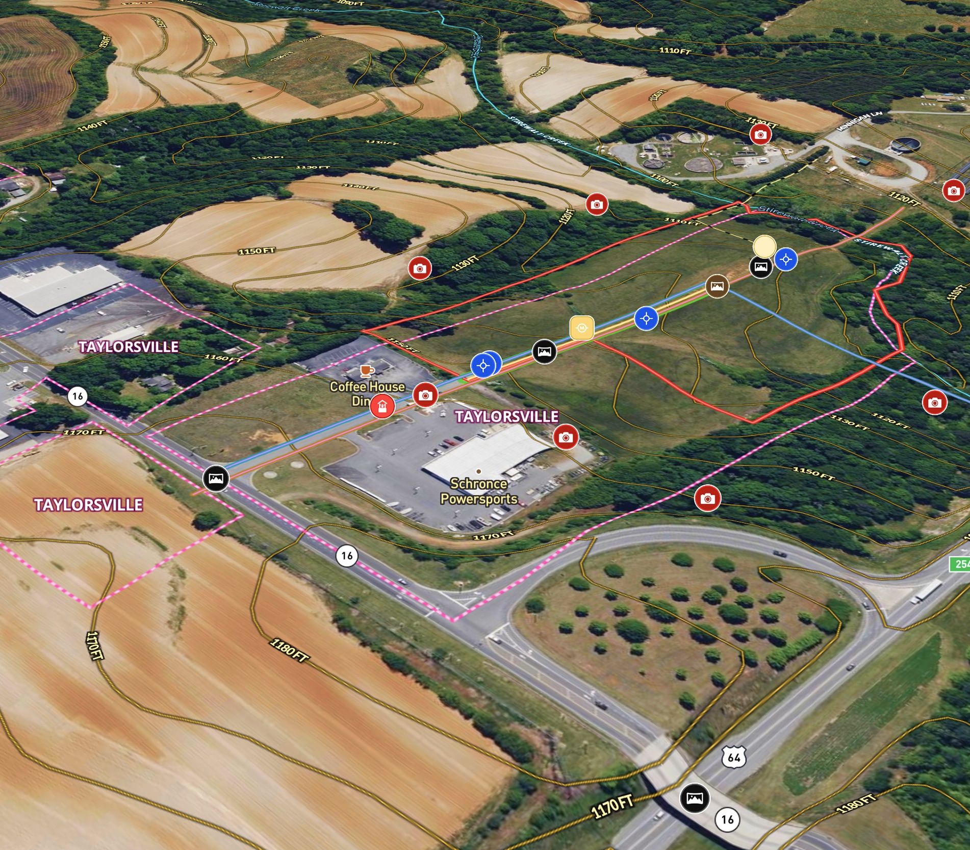
Commercial + Development Listing in NC
Mossy Oak uses Land id® GIS mapping software to showcase this ±11.90-acre land parcel with a real estate map highlighting utility availability, highway access, floodplain, and development potential.
Listing
Commercial
Panoramics
Property Development

Farm & Ranch
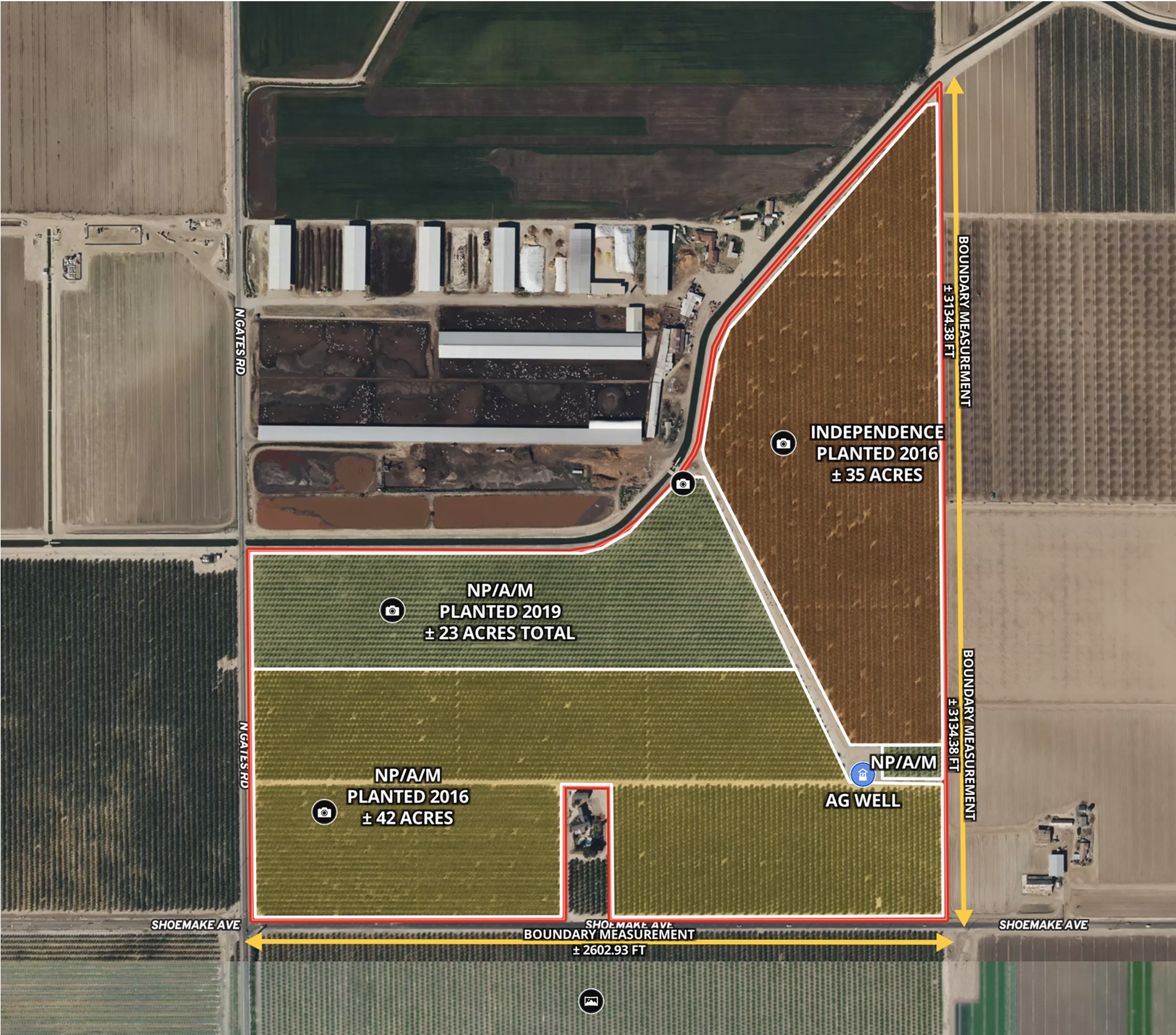
CA Almond Farm – 107 Acres
Todd Peterson uses Land id® GIS mapping software to embed real estate maps that showcase an almond farm details for a standout listing experience.
Listing
Agricultural
Rural
Soil
Water
Farm & Ranch
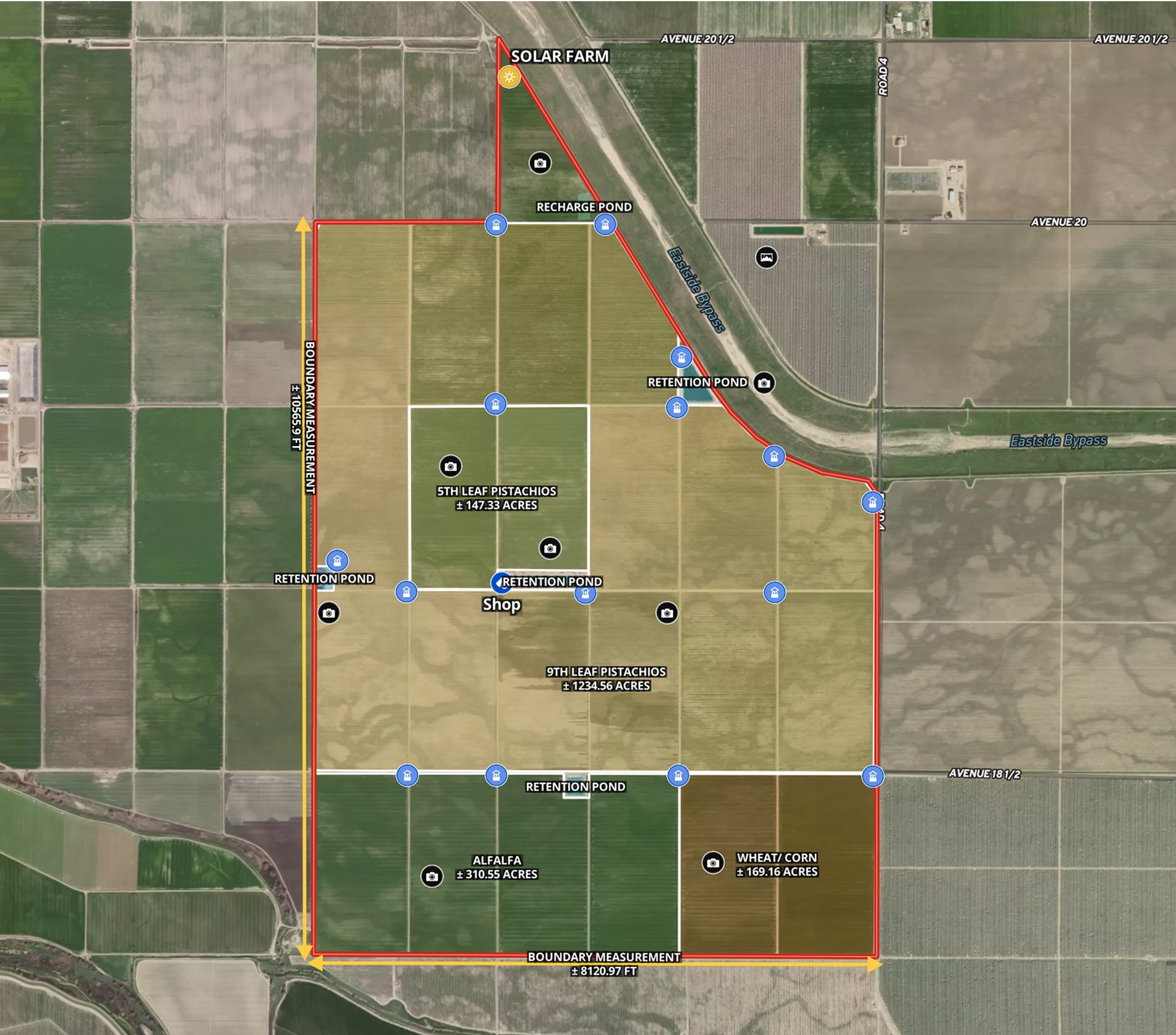
Ag Farm in Madera County, CA
Todd Peterson uses Land id® GIS mapping software to embed real estate maps that showcase detailed layout of productive California farmland.
Listing
Agricultural
Rural
Soil
Water

Planning
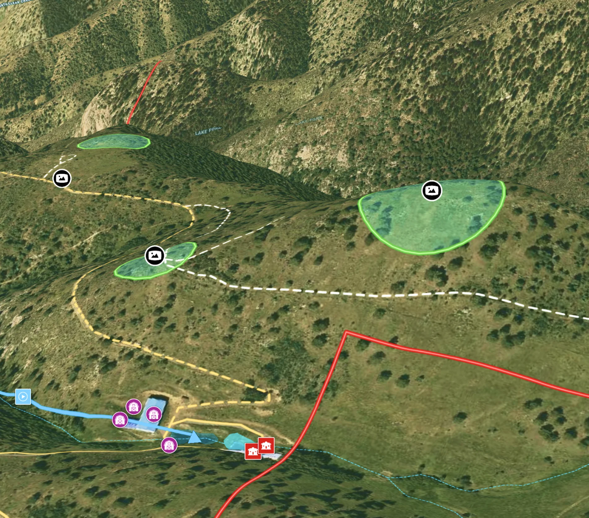
Potential Build Sites on Colorado Mountain Ranch
Enhance remote property planning with Land id®, integrating 360° views and drone paths for informed landowner choices.
Rural
Land owner
Land management
Panoramics