
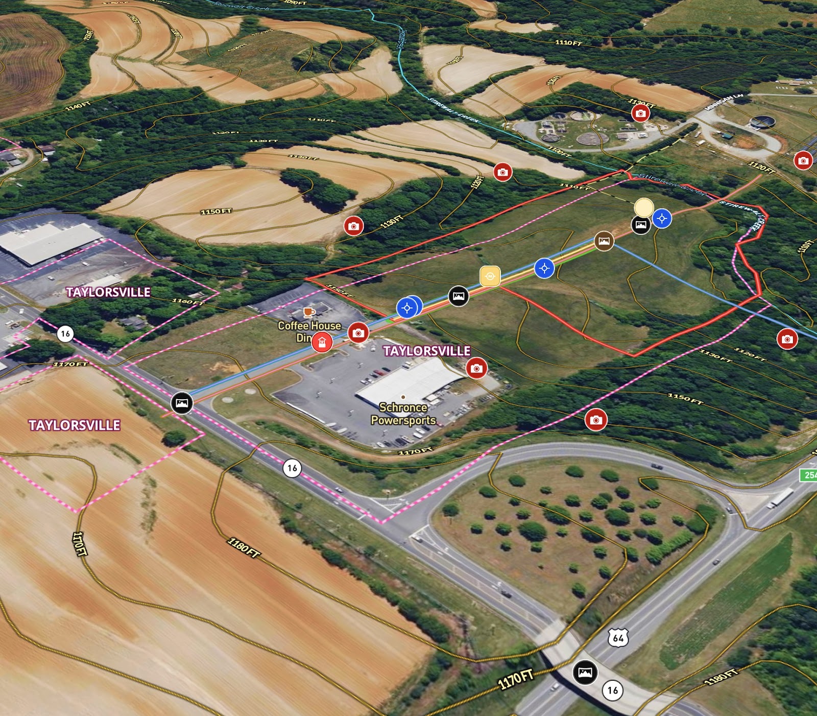
Mossy Oak Properties was marketing an ±11.90-acre commercial development tract within the Taylorsville city limits of Alexander County, North Carolina. To support the listing, the broker Sean Maloy needed a custom map that could:
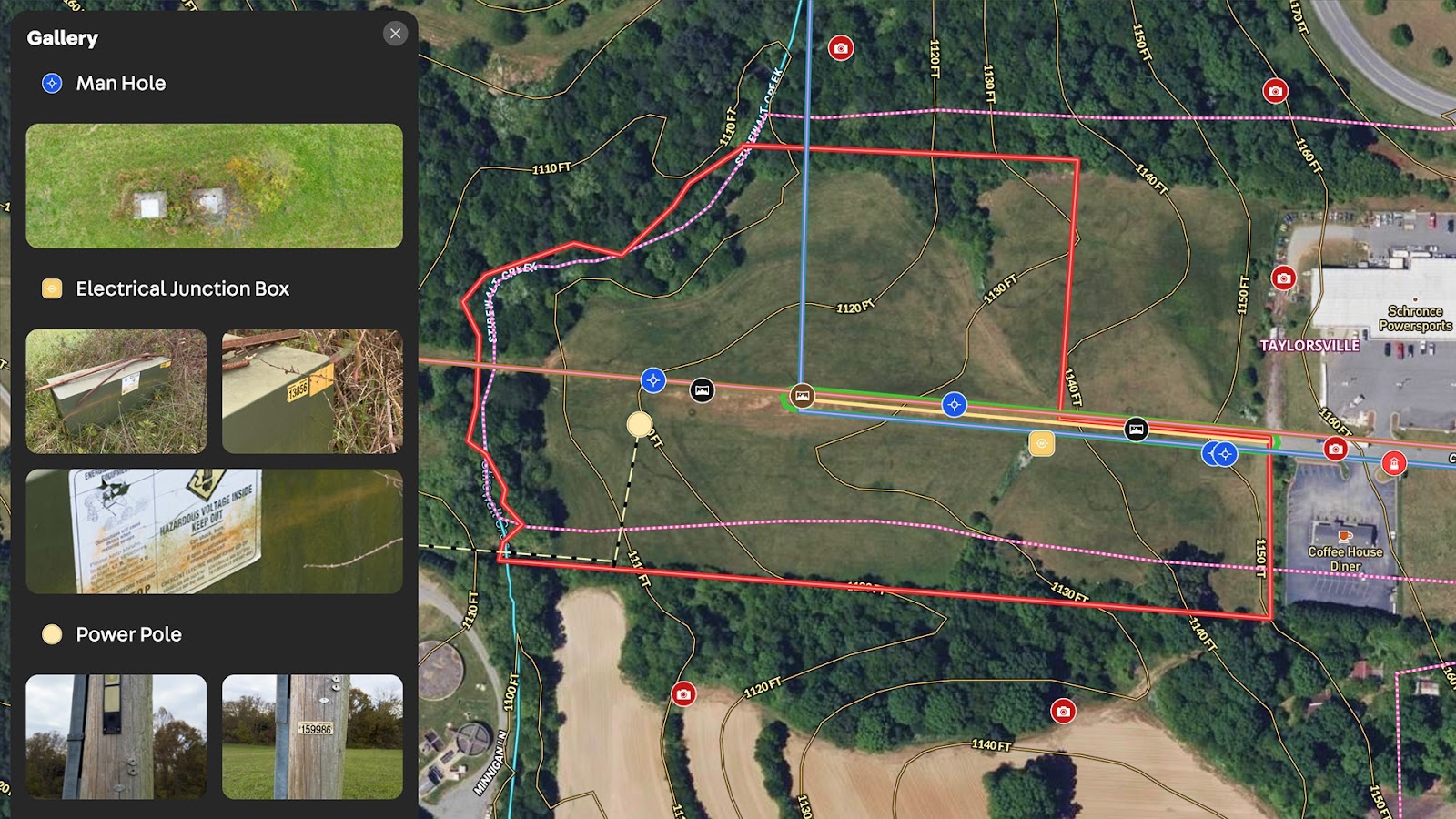
- Highlight the parcel boundaries and cleared acreage.
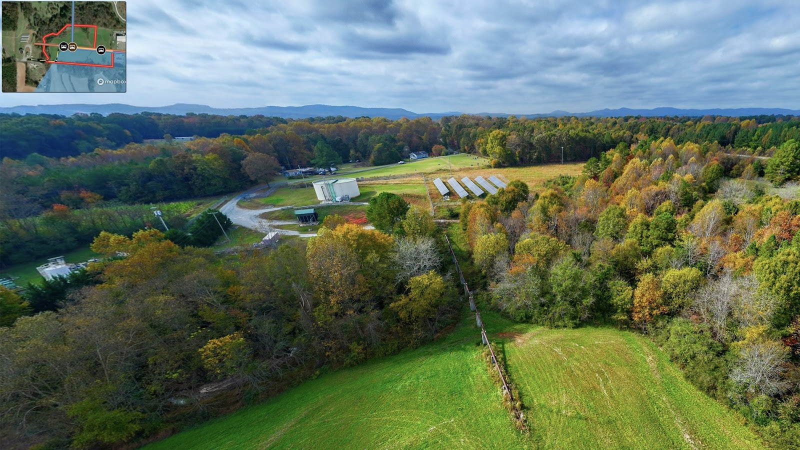
- Show access to utilities and proximity to major highways.
- Delineate the creek and floodplain for informed planning.
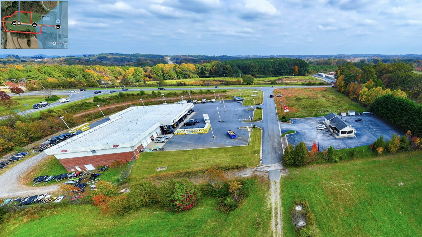
Zoned Regional Commercial (RC), the property has county water/sewer, electricity on site, and natural gas nearby—making it ready for immediate development. With frontage off Chevy Drive and visibility from NC Highways 16 and 64, the site is well-positioned for businesses seeking regional reach.
The interactive map clearly outlines the terrain, floodplain, and infrastructure—helping prospective buyers quickly understand the land’s potential. With Land id®, listings like this are easier to evaluate and market with confidence.
Learn How to Create a Map Like This:
- How to make maps in Land id
- Draw detailed maps by adding items
- Add labels to maps and mapped items
- Embed photos, videos, 360° walkthroughs, and more onto your map
- Add panoramic images
- Visualize maps in 3D
Keep Exploring


5.6 Acre Rural Listing in Bozeman, MT

Commercial Real Estate Off-Market Prospecting

Subdivided Lots for Sale

Data Center Development Site Analysis
Take Your Mapping to the Next Level
Mapping is just the beginning. Land id is the #1 tool for researching, discovering, and showcasing land, and we're here to help you make the most of it, every step of the way.

